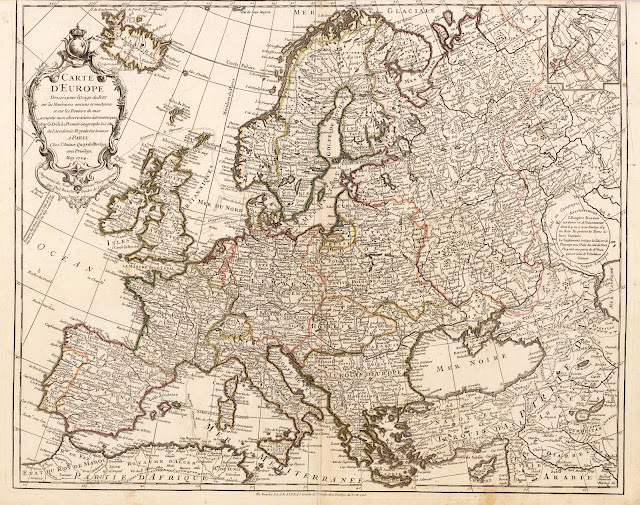
Europe Buache, Phillip Carte D'Europe dressee pour l'Usage du Roy sur les Ilineraires anciens et modernes et sur les routiers de mer assujetis aux observations astronomiques. Par G. Delisle, Premier Geographe de S.M. de l' Academie Royale des Sciences. A Paris, chez l'Auteur, Quay del Horloge avec Privilege, May 1724. - Augmentee des Nouvles connoissces Geographuquess par Phil. Buache Gendre de l'Auteur Janvier 1760 et 1769.
Paris, Dezauche, 1769 [49,6 x 61,5 cm]
Copper engraving, hand colored in outline when published. This antique map shows Europe divided up into its countries and the adjacenting regions Russia, the Middle East and North Africa. The map is accurately detailed engraved and shows many place names, rivers, mountains, lakes etc. In the upper left corner we find the large allegoric title cartouche with a detailed title and dedication to the famous French cartographer Guillaume De L'Isle, on whom the cartographic information of this map is based. This is the revised edition 1769, formerly published by Ph. Buache in 1745. In the upper right corner we find an inset map, which shows a part of Russia and Nova Zembla. A small circular inset with an text advertisement on the Russian Empire is engraved near the Caspian Sea.
In very good to excellent condition. The upper margin cut close to the engraved border line, as published in the atlas.


