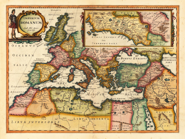
ΡΩΜΑΪΚΗ ΑΥΤΟΚΡΑΤΟΡΙΑ Imperium Romanum Auth. Phil. Briet e societ. Iesu. Amsterdam, Janssonius Joan. 1653 [38,5 x 52 cm]
Copper-engraving, decorative handcolored in outline and wash. Published in Joan. Jansson's historical atlas. A highly decorative map of the Roman Empire based on the cartographic source after Philip Briet. In the upper left corner with a decorative title cartouche held by a Roman and in the upper right corner with a large inset map of ancient Latium (the area around Rome).


